


Coastal flooding is a significant weather-related hazard that affects millions of people living near shorelines. A Coastal Flood Advisory is issued by meteorological agencies, such as the National Weather Service (NWS) in the United States, to alert residents of potential flooding that may pose a threat to life and property. Unlike more severe warnings, an advisory indicates that flooding is expected to be a nuisance rather than catastrophic, but it still requires caution and preparedness.
This comprehensive article explores:
-
What a Coastal Flood Advisory means
-
Causes of coastal flooding
-
Areas most at risk
-
How advisories are issued
-
Safety precautions
-
Long-term mitigation strategies
By understanding these factors, coastal communities can better prepare for and respond to flood threats.
What is a Coastal Flood Advisory?
A Coastal Flood Advisory is a weather alert issued when minor flooding is anticipated along coastlines, often due to high tides, storm surges, or heavy rainfall. While not as severe as a Coastal Flood Warning, it indicates that inundation of low-lying areas is likely, potentially causing:
-
Road closures
-
Beach erosion
-
Minor property damage
-
Disruptions to coastal activities
Key Characteristics of an Advisory:
-
Flooding Depth: Typically 1 to 2 feet above ground level.
-
Duration: Lasts a few hours, usually during high tide.
-
Impact: More of an inconvenience than a life-threatening event, but can escalate if conditions worsen.
Causes of Coastal Flooding
Several factors contribute to coastal flooding, including:
1. High Tides (King Tides)
-
Perigean Spring Tides: Occur when the moon is closest to Earth, amplifying tidal forces.
-
Seasonal Variations: Higher tides are common during full and new moons.
2. Storm Surge
-
Tropical storms and hurricanes push seawater inland, leading to rapid flooding.
-
Even distant storms can generate large waves that affect coastlines.
3. Heavy Rainfall and Runoff
-
Intense rainfall can overwhelm drainage systems, especially in urban coastal areas.
-
Combined with high tides, this leads to compound flooding.
4. Sea Level Rise
-
Climate change is causing global sea levels to rise, increasing the frequency of coastal flooding.
-
Low-lying regions (e.g., Miami, Norfolk, Bangladesh) are experiencing more “sunny day flooding.”
5. Wind-Driven Waves
-
Strong onshore winds pile up water along coastlines, exacerbating flooding.
Areas Most at Risk
Certain regions are more vulnerable to coastal flooding due to geographic and climatic factors:
1. Low-lying Coastal Cities
-
Miami, Florida: Faces frequent tidal flooding due to porous limestone bedrock.
-
New Orleans, Louisiana: Sits below sea level, relying on levees for protection.
-
Venice, Italy: Experiences acqua alta (high water) due to tides and subsidence.
2. Barrier Islands and Beaches
-
Narrow strips of land (e.g., Outer Banks, NC) are easily overwashed by storm surges.
3. River Deltas and Estuaries
-
Regions like the Mississippi Delta and the Ganges-Brahmaputra Delta (Bangladesh) are prone to flooding from both rivers and seas.
4. Areas with Weak Infrastructure
-
Poor drainage, outdated seawalls, and lack of flood barriers increase vulnerability.
How Coastal Flood Advisories Are Issued
Meteorological agencies use advanced tools to predict and issue advisories:
1. Tide Gauges and Buoys
-
Measure real-time water levels and wave heights.
2. Satellite and Radar Data
-
Track storms, rainfall, and sea surface conditions.
3. Computer Models
-
Predict storm surge and tidal impacts (e.g., SLOSH model for hurricanes).
4. Local Observations
-
Reports from emergency managers and the public help refine forecasts.
When flooding is expected to meet advisory criteria (typically 1–2 feet above normal), agencies issue alerts via:
-
Weather radios
-
Mobile apps (e.g., FEMA, Weather Channel)
-
Social media and news broadcasts
Safety Precautions During a Coastal Flood Advisory
While advisories indicate minor flooding, taking precautions can prevent accidents and property damage.
Before Flooding Occurs
-
Monitor Weather Updates: Stay informed via NOAA Weather Radio or trusted apps.
-
Know Your Evacuation Routes: Identify the nearest high ground.
-
Protect Property: Move vehicles to higher ground, use sandbags if necessary.
-
Check Drainage Systems: Ensure gutters and storm drains are clear.
During Flooding
-
Avoid Flooded Roads: Just 6 inches of water can sweep away a car.
-
Stay Away from Beaches: Strong currents and erosion are dangerous.
-
Do Not Walk Through Floodwaters: Hidden debris, sewage, and downed power lines pose risks.
After Flooding
-
Check for Damage Inspect your home for structural issues.
-
Avoid Contaminated Water Floodwater may carry hazardous chemicals.
-
Report Flooding Help authorities track impacted areas.
Long-Term Mitigation Strategies
To reduce future risks, communities and governments must invest in resilience measures:
Natural Barriers
-
Wetlands & Mangroves Absorb storm surges.
-
Dune Restoration Protects against erosion.
Engineered Defenses
-
Seawalls & Levees Provide physical barriers (but can fail under extreme conditions).
-
Floodgates & Pump Systems Used in cities like Rotterdam and New Orleans.
Zoning and Building Codes
-
Elevate Homes Especially in flood-prone zones.
-
Restrict Coastal Development Prevent construction in high-risk areas.
Community Preparedness
-
Flood Insurance (NFIP) Helps homeowners recover faster.
-
Public Awareness Campaigns Educate residents on flood risks.
Conclusion
A Coastal Flood Advisory serves as an early warning for minor but disruptive flooding. While not as severe as a warning, it signals the need for caution, especially in vulnerable areas. Understanding the causes—such as high tides, storm surges, and sea level rise helps communities prepare effectively.
By following safety measures and investing in long-term mitigation, coastal residents can reduce risks and adapt to increasing flood threats. As climate change intensifies, proactive planning and resilient infrastructure will be crucial in safeguarding lives and property along the world’s coastlines.
Final Takeaways:
-
Stay informed through reliable weather sources.
-
Avoid floodwaters and follow evacuation orders if necessary.
-
Support policies that enhance coastal resilience.
Frequently Asked Questions
What is a Coastal Flood Advisory?
A weather alert issued when minor flooding (1-2 feet) is expected along coastlines, causing nuisance flooding but not immediate danger.
How does it differ from a Warning?
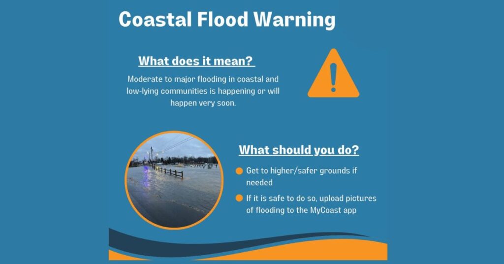
Advisories indicate minor flooding, while Warnings signal more severe, life-threatening flooding (2+ feet).
What causes coastal flooding?
High tides, storm surges, heavy rainfall, sea level rise, and strong onshore winds.
How long does a Coastal Flood Advisory last?
Typically a few hours, often around high tide. However, prolonged advisories may occur during multi-day storms or extreme tides.
Does flood insurance cover damage from a Coastal Flood Advisory?
Standard homeowners’ insurance usually does not cover flood damage. You need a separate National Flood Insurance Program (NFIP) policy or private flood insurance.
How can coastal communities reduce flood risks long-term?
-
Restore natural barriers (wetlands, dunes, mangroves).
-
Improve drainage systems and seawalls.
-
Enforce stricter building codes in flood zones.
-
Promote flood insurance and public awareness.
Is climate change increasing coastal flooding?
Yes. Rising sea levels and stronger storms due to climate change are making coastal flooding more frequent and severe, even outside of major storms.
Where can I find real-time flood maps and forecasts?
-
NOAA’s Tides & Currents (https://tidesandcurrents.noaa.gov)
-
FEMA Flood Map Service Center (https://msc.fema.gov)
-
USGS Water Alerts (https://water.usgs.gov/wateralert/)